This is part of our IndyVitals blog series, exploring the data behind IndyVitals.org.
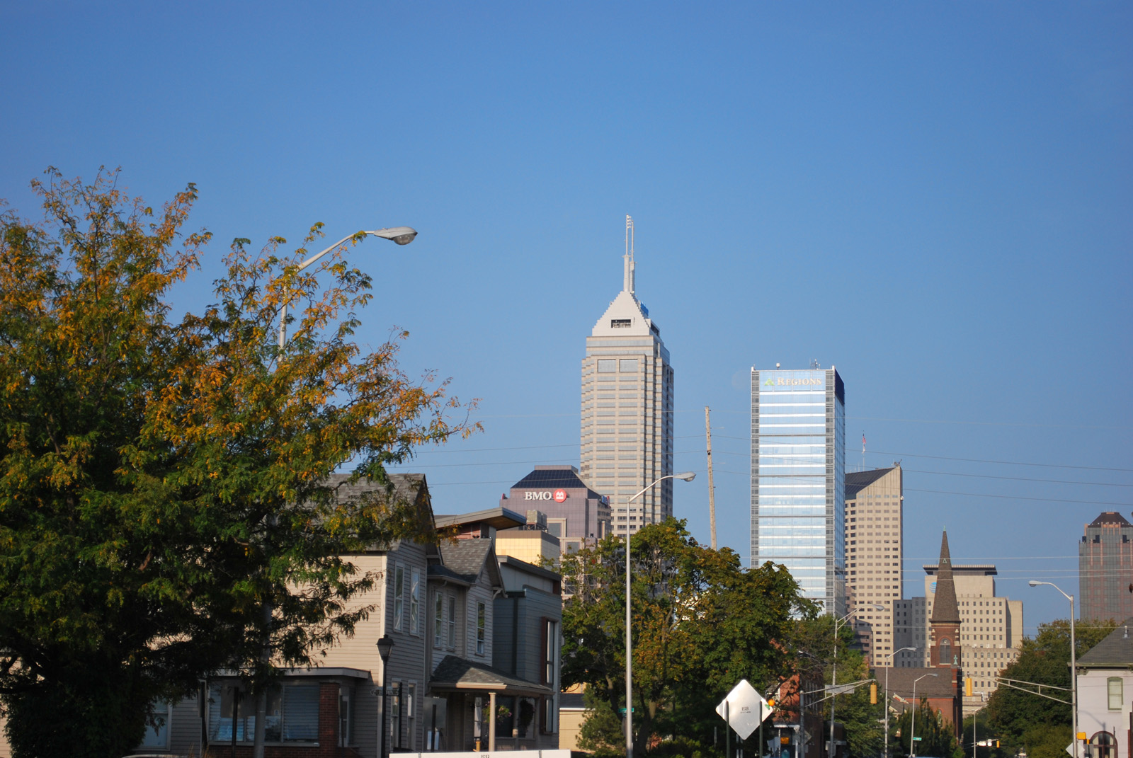
Marion County in Central Indiana has noted a trend, especially among young people, of a preference for a car-less existence and mixed zones of residential, green space, and businesses in an appealing environment. People want to live and work close enough that they can walk or bike. Although not formerly considered a city that offered many options in that regard, Indianapolis is working on making the city a better place to live, work and visit. Improvements have been made with the provision of extensive greenways such as the Monon and Cultural Trails, electric car-sharing services such as Blue Indy, bike sharing programs, and a more user-friendly IndyGo bus route network.
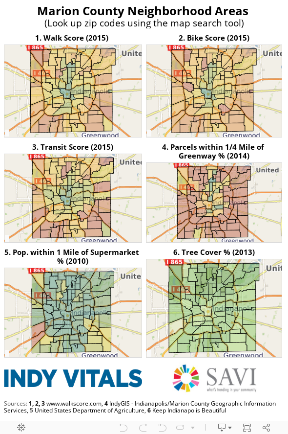
The six maps below compile data from the online IndyVitals tool to help you better understand the walkability and livability of Indianapolis neighborhood areas. The different metrics characterize neighborhoods by the ease with which one can get around using public transportation and pedestrian friendly routes. The walk, bike, and transit scores come from walkscore.com, a site and data collection originally built by Front Seat with the mission of promoting walkable neighborhoods as a simple solution to improve health, the environment, and the economy. (You can check out their full methodology here: walkscore.com/methodology.shtml.) The rest of the data was compiled by the staff of The Polis Center.
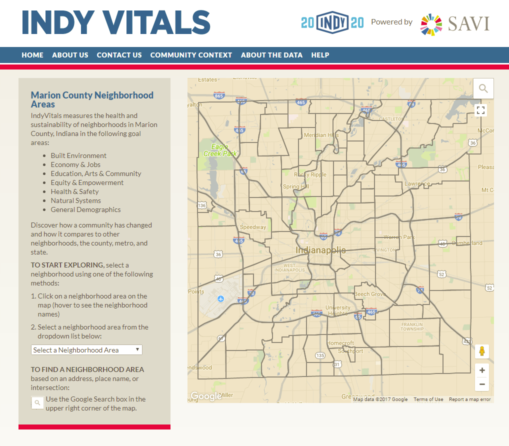
IndyVitals offers a tremendous amount of information about various Indianapolis neighborhoods. We encourage you to visit indyvitals.org and explore the areas in which you may want to live so you have a good snapshot to help make decisions.
Next Up
 What Type of Businesses are Located in Your Neighborhood?
This is part of our IndyVitals blog series, exploring the data behind IndyVitals.org. Have you ever wondered exactly what type of businesses are offered in your neighborhood or an area […]
 SAVI Talks! IndyVitals
Don’t miss this great chance to learn about the IndyVitals digital tool at the first SAVI Talks! event of 2016 on Thursday, June 30, at WFYI, 1630 N. Meridian Street, […]
 What Census Tract is that?
A user recently asked me – “In which census tract is this particular address located?” SAVI can tell you. Also, if you have some mysterious census tract number, SAVI can […]
- The Changing Demographics of the Foreign-Born Population in America and Indiana
We recently came across these interesting maps created by the Pew Research Center showing the changing demographics of the foreign-born population in America. Several media outlets featured these fascinating maps where Pew compared the biggest sources […]