Data Notes:
For this blog, three different datasets were used.
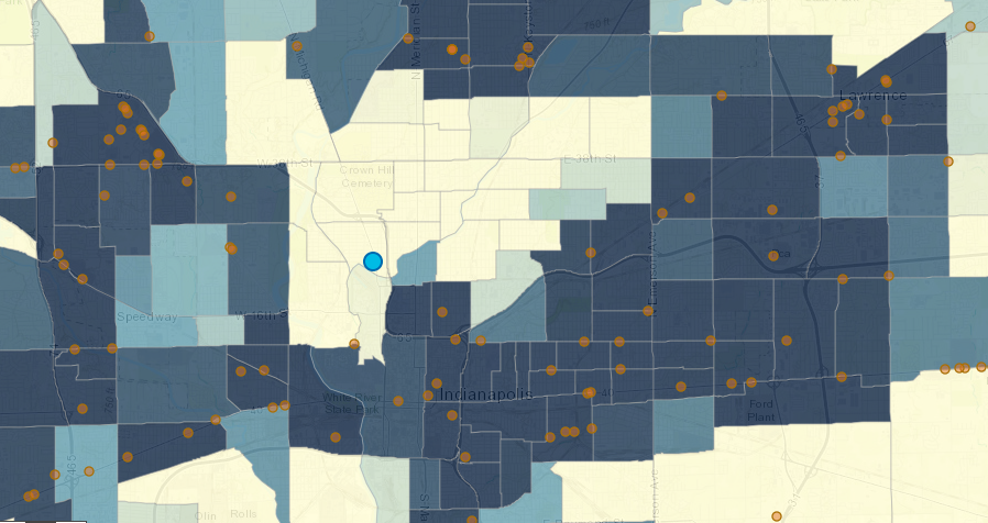
- SAVI Grocery Stores and Supermarkets: This data is curated from the Marion County Health Department food inspection reports.
- Marion County street centerlines: This data comes from the OpenIndy Data Portal.
- Bus routes and stops: This data comes from the OpenIndy Data Portal.
Methodology
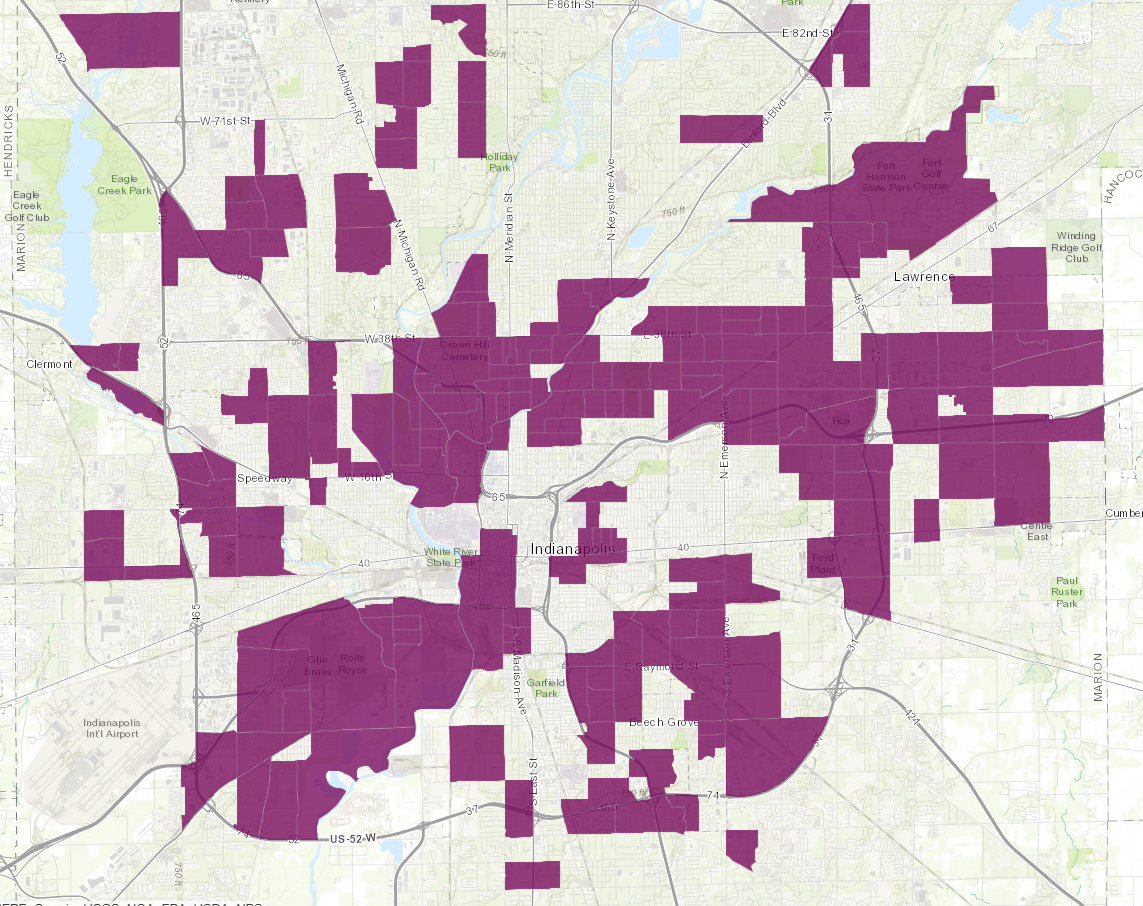
This analysis was done by finding the centroid for each block group. These centroids were then used as starting points for each travel mode. The centroid is the geographic center of a block group.
Walking: Walking time was calculated using a walking speed of 2.8 miles per hour, the same speed used by Google Maps.
Driving: Driving times were calculated with ArcGIS Online, using data provided by HERE. Traffic estimates were based on Monday at 6 p.m.
Bus: Bus routes were calculated by using a ¼ mile network distance around block group centroids. The stops that were within a quarter mile of the block group center were used as origin points to grocery stores. Bus times were calculated using the IndyGo basic service standard speed of 14 miles per hour.
Next Up
 Estimated 200,000 Indy Residents Live in Food Deserts
Using recent, local data to improve on food access measures, we find that an estimated 200,000 Indianapolis residents have low food access and live in low income areas.
 City Funds Flanner House Micro-Grocery in Food Desert
- Who Has Access to Groceries and Farmers’ Markets?
The USDA defines food deserts as a census tract where “at least 500 people and/or at least 33 percent of the census tract’s population reside more than one mile from […]
 A Model to Mitigate Hunger
By Sharon Kandris It’s clear that hunger and food insecurity are growing problems in Central Indiana. We’ve recently partnered with two Central Indiana organizations (Northside Mission Ministry of Second Presbyterian […]